← Back to huts
Bilíkova Hut
▲ 1255 m a.s.l.
It stands right next to the Hrebienok resort on the south-eastern slope of Slavkovský Peak, exactly on the site where the Studený Potok spa complex once stood.
Route length
2.8 km one way
5.6 km round trip
5.6 km round trip
Elevation gain
305 m
Time (one way)
~0:57 h
Difficulty*
1/5
Trailhead
Starý Smokovec (995 m a.s.l.)
📍 GPS parking
N 49.14108°, E 20.22142°
🔗 Route on Mapy.com
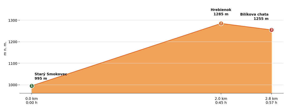
Elevation profile (podľa publikovaných dát trasy, nie z GPX)
Route breakdown
| 1 · Starý Smokovec 995 m · 0.0 km · 0:00 h | Starting point — the route begins here. |
| 2 · Hrebienok 1285 m · 2.0 km · 0:45 h | The route passes by Hrebienok, where you can rest and refill water. |
| 3 · Bilíkova Hut 1255 m · 2.8 km · 0:57 h | Bilíkova Hut — the end of the route. |
ℹ Practical info
| 🅿 Parking | Starý Smokovec — paid car park |
| 🚻 Toilets | In the hut |
| 💧 Water | At the hut |
| 🛏 Accommodation | Rooms and apartments |
| 🚡 Cable car | Yes, to Hrebienok (300 m from the hut) |
| ❄ Operating season | Year-round |
| ☀ Best time | Year-round |
| 🧭 Orientation | Right at the Hrebienok resort |
| 🎨 Trail marking | 🟢 green (Starý Smokovec → Hrebienok), 🔴 red (→ Bilíkova Hut) |
| 📞 Contact | +421 949 579 777, info@bilikovachata.sk |
| 🚨 Emergency number | Mountain Rescue Service: 18 300 (or 112) |
What to bring
🎒 Hiking boots
🎒 Trekking poles
🎒 Waterproof jacket
🎒 Water (min. 1.5 l)
🎒 Cash (not everywhere accepts cards)
🎒 Map / GPS / phone
⚠ What to watch out for
- Opening hours and accommodation availability may vary by season — check the current status directly on the hut's website.
- In winter and spring the access route may be closed or avalanche-prone — check the forecast and avalanche situation.
- The hut may be fully booked, especially on weekends in season — we recommend booking accommodation in advance.