
The highest of all saddles on the marked routes of the High Tatras — it connects the Malá Studená and Zadná Javorová Valleys. The scree gully below it is one of the more demanding sections of the ridge crossings.
Route length
1.0 km one way
2 km round trip
2 km round trip
Elevation gain
361 m
Time (one way)
~1:00 h
Difficulty*
3/5
Trailhead
Téryho Hut (2,015 m a.s.l.)
📍 GPS parking
N 49.14108°, E 20.22142°
🔗 Route on Mapy.com
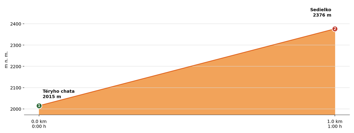
Elevation profile (podľa publikovaných dát trasy, nie z GPX)
Route breakdown
| 1 · Téryho Hut 2015 m · 0.0 km · 0:00 h | Starting point — the route begins here. |
| 2 · Sedielko 2376 m · 1.0 km · 1:00 h | Sedielko — the end of the route. |
ℹ Practical info
| 🅿 Parking | Starý Smokovec — paid car park |
| 🚻 Toilets | Téryho Hut |
| 💧 Water | Téryho Hut (cold water) |
| 🏠 Hut | Téryho Hut (near the trailhead) |
| 🚡 Cable car | Yes, to Hrebienok |
| ❄ Ascent season | Closed 1 Nov – 31 May |
| ☀ Best time | June — October |
| 🧭 Orientation | Demanding scree terrain, recommended for experienced hikers only. Since July 2026 a new, rebuilt trail (the section from the junction below Sedielko to the saddle was rerouted onto more stable rocky ground, with new steel rungs and chains installed). |
| 🎨 Trail marking | 🟢 green (the whole route, Téryho Hut → Sedielko) |
| 🚨 Emergency number | Mountain Rescue Service: 18 300 (or 112) |
What to bring
🎒 Sturdy hiking boots with a stiff sole
🎒 Trekking poles
🎒 Helmet (recommended on exposed rocky sections)
🎒 Waterproof and windproof jacket
🎒 Extra warm layer
🎒 Water (min. 2 l)
🎒 Food / energy bars
🎒 First aid kit
🎒 Map / GPS / phone
⚠ What to watch out for
- The section below the saddle tends to be steep, rocky and in places exposed — suitable footwear and experience matter.
- Weather in high-mountain terrain changes very quickly — turn back in a storm, fog or high wind; a ridge is no place to wait it out.
- In winter and spring this terrain carries a high avalanche risk — don't come here at that time without experience and the right gear.
- There is no water available along the route — bring an adequate supply in advance.