← Back to peaks
Brestová
▲ 1902 m a.s.l.
A grassy summit in the western part of the main ridge of the Western Tatras, offering a panoramic view of the Roháče, the Chočské Peaks, the Fatra mountains, Orava and Liptov. The route is short but steep and physically demanding.
Route length
5.8 km one way
11.6 km round trip
11.6 km round trip
Elevation gain
975 m
Time (one way)
~3:14 h
Difficulty*
2/5
Trailhead
Zverovka (1,030 m a.s.l.)
📍 GPS parking
N 49.24862°, E 19.71135°
🔗 Route on Mapy.com
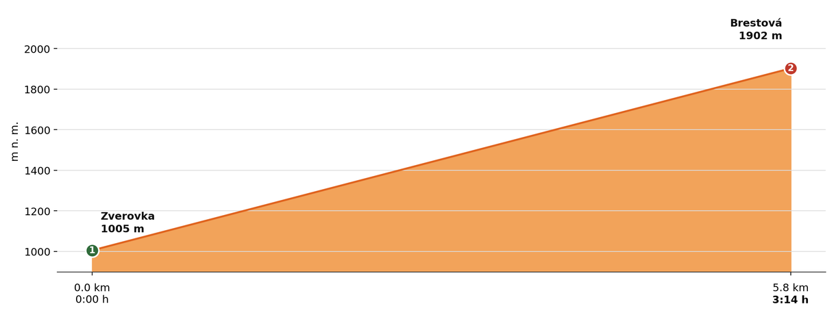
Elevation profile (podľa publikovaných dát trasy, nie z GPX)
Route breakdown
| 1 · Zverovka 1005 m · 0.0 km · 0:00 h | Starting point — the route begins here. |
| 2 · Brestová 1902 m · 5.8 km · 3:14 h | Brestová summit — the end of the route. |
ℹ Practical info
| 🅿 Parking | Zverovka — car park by the hut |
| 💧 Water | Not available in the upper sections — bring an adequate supply |
| 🏠 Hut | Chata Zverovka hut (at the start) |
| 🚡 Cable car | No |
| ❄ Ascent season | Closed 1 Nov – 15 Jun |
| ☀ Best time | June — October |
| 🧭 Orientation | Marked trail, large elevation gain over a short distance, exposed sections near the start |
| 🎨 Trail marking | 🔵 blue (whole route, Zverovka → Brestová) |
| 🔄 Descent | Same route back |
| 🔗 Combination | Can be combined with Sivý vrch and Salatín in a loop from Bobrovecká Vápenica, or extended further to include Baníkov via Spálená and Pachoľa. |
| 🔀 Alternative route | It can also be started from Jalovec via Bobrovecká Valley and Pálenické Saddle instead of directly from Zverovka — on this longer route Brestová is the first peak before continuing on to Salatín (combined with Salatín approx. 1,363 m of ascent, ~10:55 h, demanding). |
| 🚨 Emergency number | Mountain Rescue Service: 18 300 (or 112) |
What to bring
🎒 Hiking boots
🎒 Trekking poles
🎒 Waterproof jacket
🎒 Water (min. 2 l)
🎒 Food / energy bars
🎒 First aid kit
🎒 Warm layer
🎒 Map / GPS / phone
⚠ What to watch out for
- Weather in the Tatras changes quickly — check the forecast and turn back if a storm approaches.
- In winter and spring (1 Nov – 31 May) the upper sections of the trail may be closed — check current conditions at tatry.sk or hzs.sk.
- Bring an adequate supply of water — refill points may not be available on high-mountain routes.