
A slender rocky peak on the main Roháče ridge between Volovec and Plačlivé, a popular destination for loop tours around the Roháče. The approach leads along a long ridge with several secured sections that require extra caution when wet.
Route length
10.1 km one way
20.2 km round trip
20.2 km round trip
Elevation gain
1,217 m
Time (one way)
~5:07 h
Difficulty*
4/5
Trailhead
Parkovisko pod Spálenou (1,000 m a.s.l.)
📍 GPS parking
N 49.23818°, E 19.71502°
🔗 Route on Mapy.com
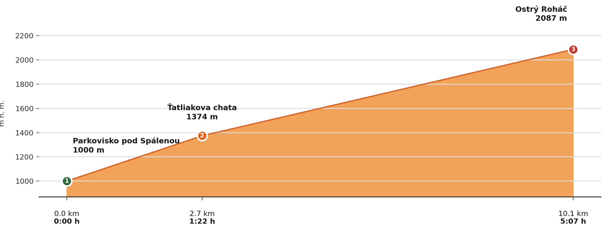
Elevation profile (podľa publikovaných dát trasy, nie z GPX)
Route breakdown
| 1 · Parkovisko pod Spálenou 1000 m · 0.0 km · 0:00 h | Starting point — the route begins here. |
| 2 · Ťatliakova Hut 1374 m · 2.7 km · 1:22 h | The route passes by Ťatliakova Hut, where you can rest and refill water. |
| 3 · Ostrý Roháč 2087 m · 10.1 km · 5:07 h | Ostrý Roháč summit — the end of the route. |
ℹ Practical info
| 🅿 Parking | Parkovisko pod Spálenou |
| 💧 Water | Available to refill at Ťatliakova Hut |
| 🏠 Hut | Ťatliakova Hut (on the route, approx. 1:20 h from the car park) |
| 🚡 Cable car | No |
| ❄ Ascent season | Closed 1 Nov – 31 May, large part of the route |
| ☀ Best time | June — October |
| 🧭 Orientation | A high-mountain, exposed and technically demanding tour along a rocky ridge secured with chains, not recommended in bad weather |
| 🎨 Trail marking | 🔴 red (Parkovisko pod Spálenou → Ťatliakova Hut), 🟢 green (→ Zábrať Saddle), 🟡 yellow (→ Rákoň), 🔵 blue (→ Volovec), 🔴 red (→ Ostrý Roháč) |
| 🔄 Descent | Same route back |
| 🔗 Combination | Can be combined with Volovec via Jamnícke Saddle (the so-called Roháče ridge tour) — approx. 20 km / 8–9 h in total, sections with chains. |
| 🚨 Emergency number | Mountain Rescue Service: 18 300 (or 112) |
What to bring
🎒 Hiking boots
🎒 Trekking poles
🎒 Helmet (recommended on chains and exposed terrain)
🎒 Waterproof jacket
🎒 Water (min. 2 l)
🎒 Food / energy bars
🎒 First aid kit
🎒 Warm layer
🎒 Map / GPS / phone
⚠ What to watch out for
- Weather in the Tatras changes quickly — check the forecast and turn back if a storm approaches.
- In winter and spring (1 Nov – 31 May) the upper sections of the trail may be closed — check current conditions at tatry.sk or hzs.sk.
- Bring an adequate supply of water — refill points may not be available on high-mountain routes.