
A popular viewpoint on the blue trail to Slavkovský Peak, with a view into the Veľká Studená Valley — in winter it serves as a destination in its own right, since the route above it toward the peak is closed. The climb is continuous but has no exposed sections and no chains.
Route length
2.7 km one way
5.4 km round trip
5.4 km round trip
Elevation gain
535 m
Time (one way)
1:30 h
Difficulty*
2/5
Trailhead
Starý Smokovec (995 m a.s.l.)
⚠ summer times — expect significantly longer times in winter snow conditions
📍 GPS parking
N 49.14108°, E 20.22142°
🔗 Route on Mapy.com
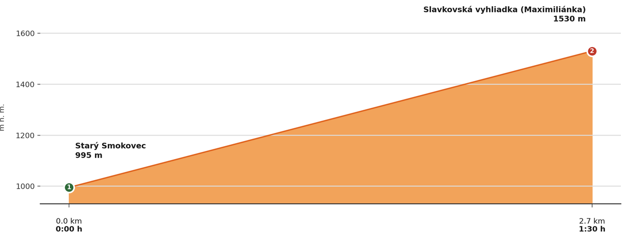
Elevation profile (podľa publikovaných dát trasy, nie z GPX)
Route breakdown
| 1 · Starý Smokovec 995 m · 0.0 km · 0:00 h | Starting point — the route begins here. |
| 2 · Slavkovská Viewpoint (Maximiliánka) 1530 m · 2.7 km · 1:30 h | A popular viewpoint looking into the Veľká Studená Valley — the destination of this winter route (Slavkovský Peak itself is closed in winter). |
ℹ Practical info
| 🅿 Parking | Starý Smokovec — paid car park |
| 💧 Water | Not available on the route — bring an adequate supply |
| 🏠 Hut | None directly on the route |
| 🚡 Cable car | No |
| ❄ Ascent season | Accessible year-round — the closure (Nov 1 – May 31) applies only above the viewpoint, toward Slavkovský Peak |
| ☀ Best time | Year-round, also as a shorter winter walk |
| 🧭 Orientation | Marked route, continuous climb, no exposed sections |
| 🎨 Trail marking | 🔵 blue (Starý Smokovec → Slavkovská Viewpoint) |
| 🚨 Emergency number | Mountain Rescue Service: 18 300 (or 112) |
What to bring
🎒 Crampons (at least light ones)
🎒 Trekking poles with snow baskets
🎒 Headlamp (spare battery for early dusk)
🎒 Warm gloves and hat
🎒 Thermos with a hot drink
⚠ What to watch out for
- Weather in the Tatras changes quickly — check the forecast and turn back in a storm.
- Beyond the viewpoint the route continues to Slavkovský Peak, which is closed in winter (Nov 1 – May 31) — in winter, turn back from the viewpoint.
- In winter the trail can be icy even on this easy section — bring crampons.
🚨 HZS emergency number: 18 300 (or 112)
⚠ Avalanche forecast (HZS)